
Map graphic design | Information design
Keywords:
Cultural precinct, tourist map, iconography, information mapping, illustrations
Brief:
In 2019, we designed the graphics and information design of a detailed tourism map of Fort Kochi area in Ernakulam, Kerala. A vibrant historical and cultural precinct of the city, Fort Kochi is a picturesque coastal area which is dotted with Dutch, Portuguese and British colonial architecture. The area is a popular tourist destination for local and foreign tourist and offers a multi-cultural experience of food, music, art and architecture. The map design was aimed at highlighting these and many other aspects of the area that were being planned at the urban scale.
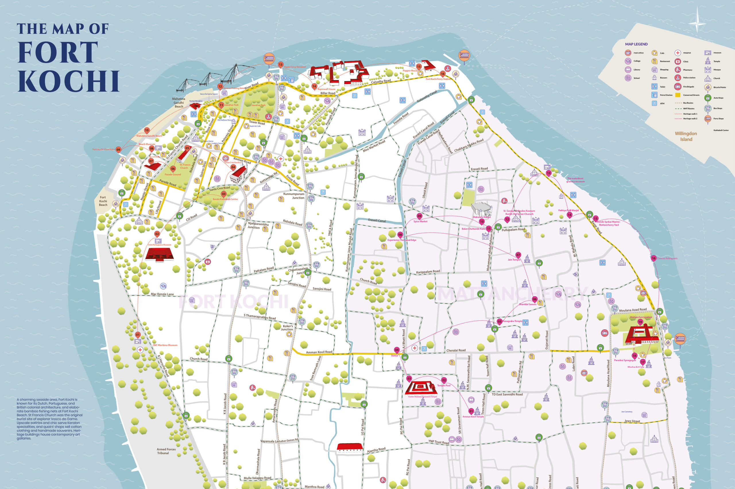
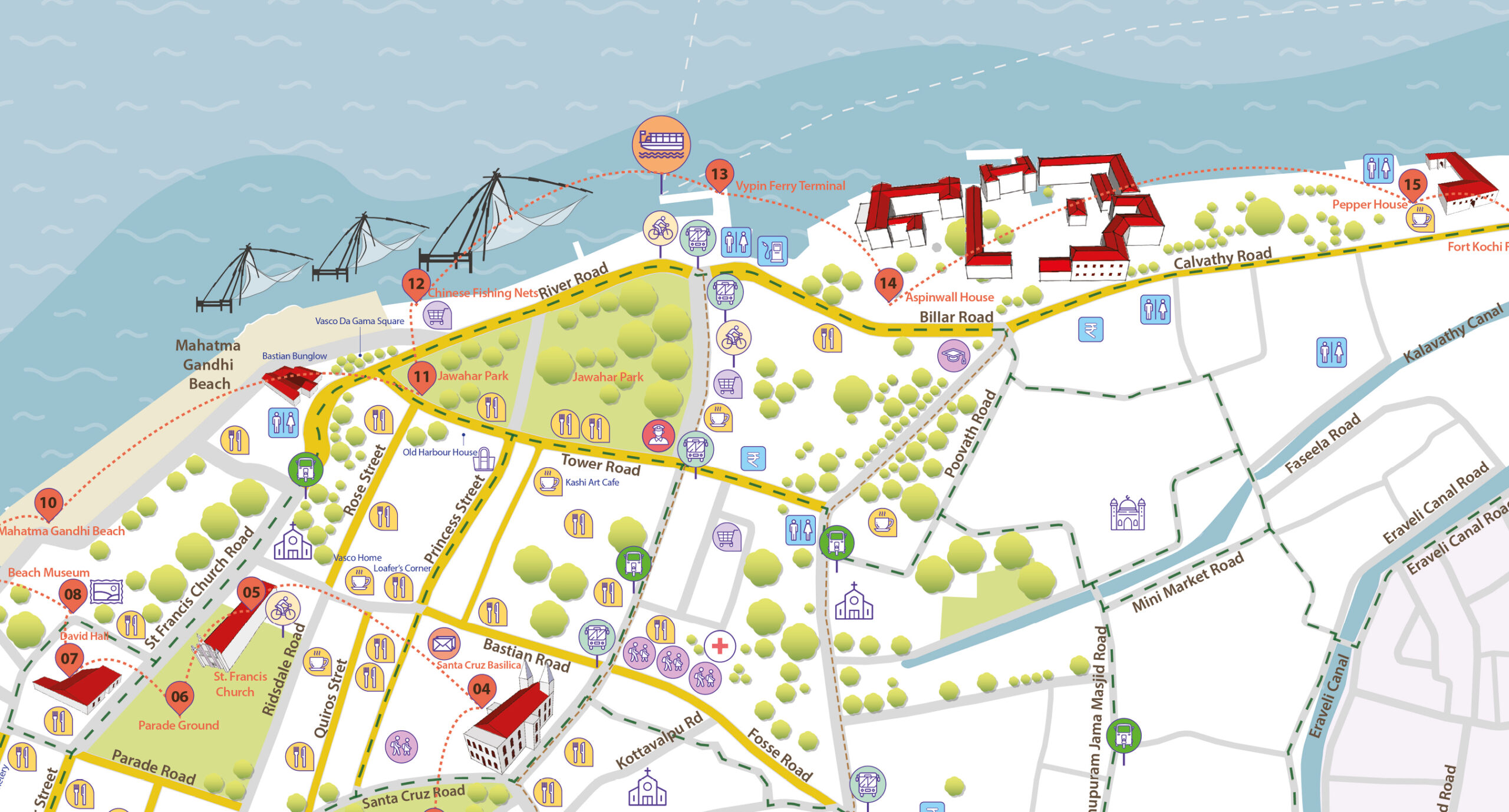
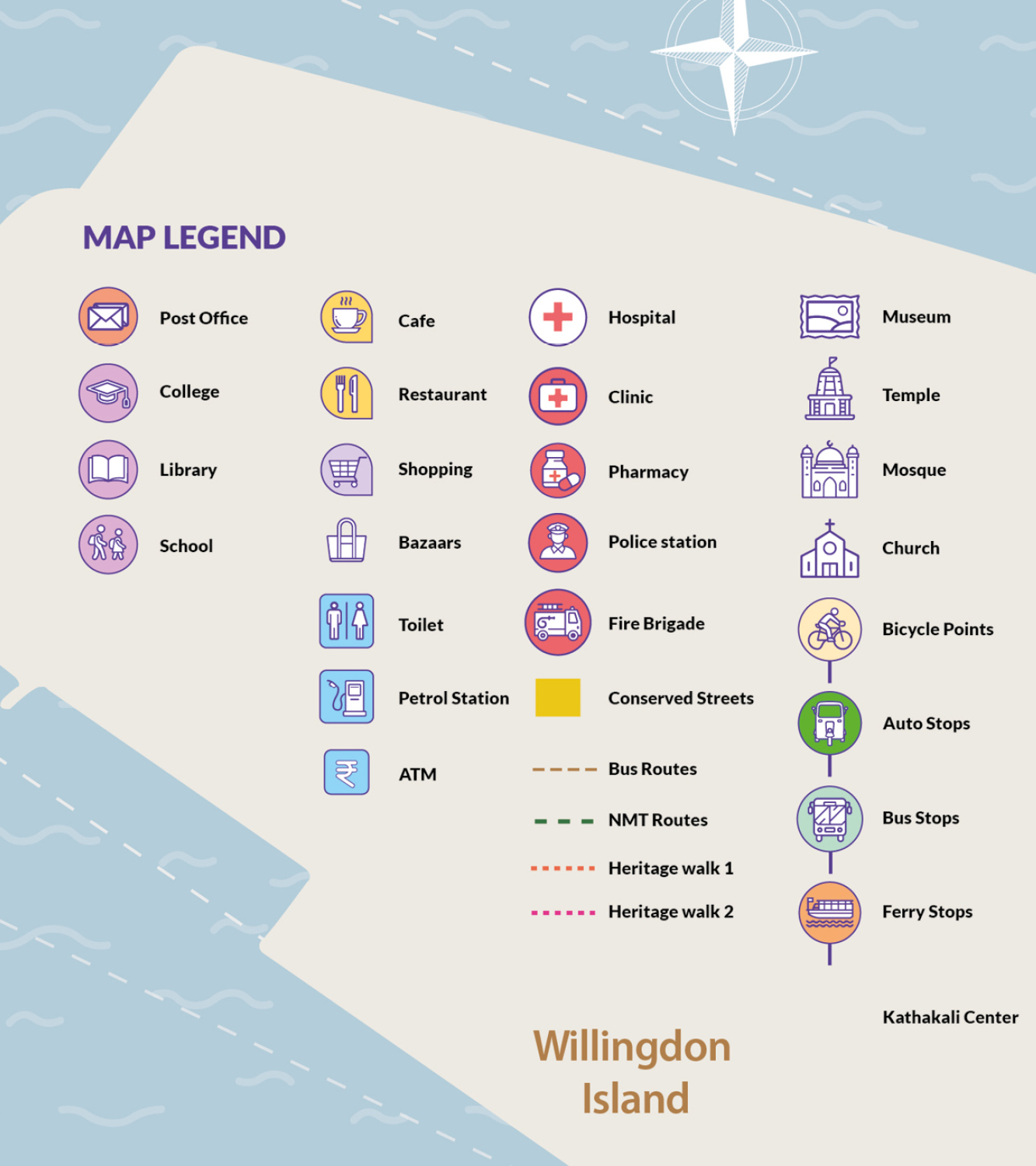
Popular tourist attractions, amenities and resources such as heritage walk and cycling routes as well as local landmarks and public facilities such as schools, hospitals and police stations were highlighted on the map. We developed a vibrant and colourful graphical language and a series of icon groups that represented clusters of information on the map.
The central idea was an ease of information dissemination and an ability to communicate in a universal way, beyond language barriers.
The result was a visually rich map that layered information in a way that created a meaningful resource for both locals and visitors to Fort Kochi.
Team:
Design — Rachita Sareen, Ajay Sapkale
Client — Ahmedabad University, Ahmedabad
Scope:
Facade design
Space design
Landscape design
Outdoor furniture design
Team:
Design — Rachita Sareen
Tensile Consultant – Vishal Wadhwani (Idea Factor)
Photography — Shweta Sauran